
After a few days in Calgary, Alberta, I headed west, on roads that increased in both altitude and impressive vistas until I arrived in Banff. I spent my first day here exploring the town, which, unexpectedly, included a hike through some spectacular scenery practically outside my hotel door. If this was the nature to be found in town, my expectations for what I would discover out in the wild over the coming week soared. I’m more than happy to say that I was never disappointed.
Two Jack Lake and Lake Minnewanka
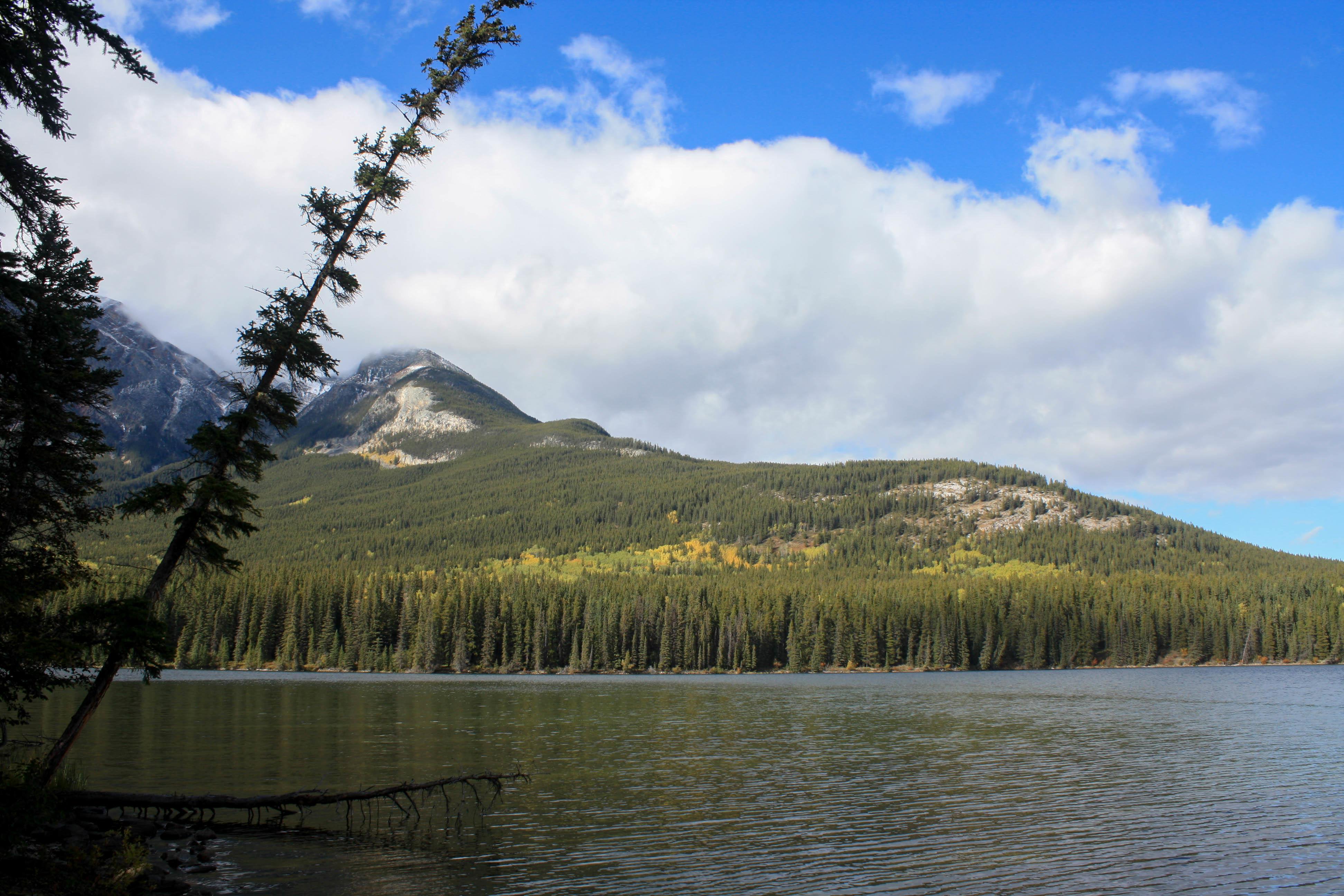
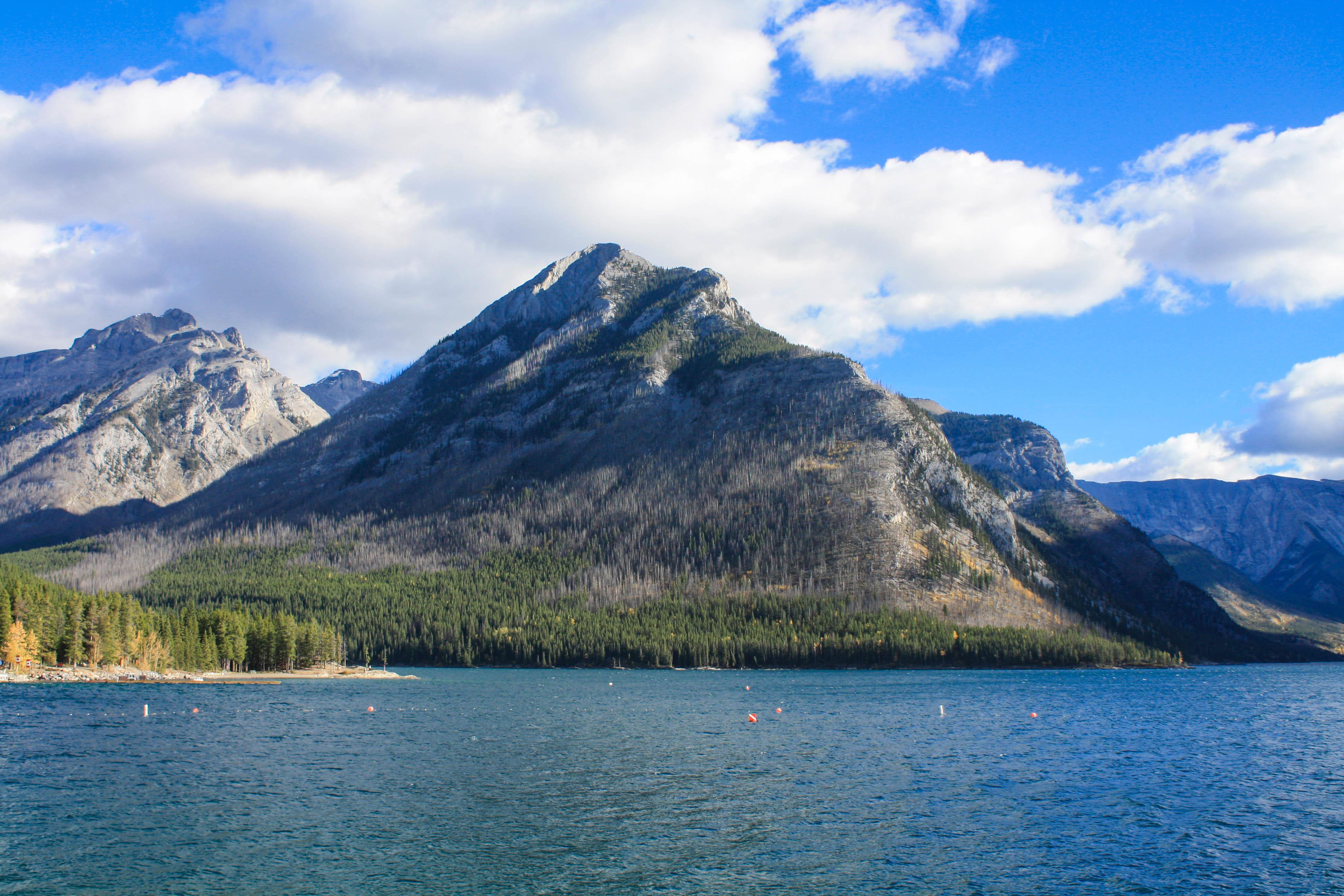 It all began with a 15-minute drive from Banff to Two Jack Lake, set against a humbling background of rugged Rocky Mountains still dusted with last winter’s snow that survived the summer. It’s a lovely spot for picnics and camping, and the unagitated waters seduce you into engaging in some swimming, kayaking, and paddling.
Two Jack Lake is a little appendage attached to the much larger Lake Minnewanka. With a length of 13 miles, it ranks as the second-longest lake in the Canadian Rockies mountain parks. Multiple rivers and streams feed this glacial lake, whose name means “Water of the Spirits.” Its maximum depth of 466′ holds a fascinating secret: A dam constructed in 1941 not only raised the lake nearly 100′; it also completely submerged both the prior dam, built in 1912, and the footings of the original 1895 dam, as well as Minnewanka Landing, a resort village that had been around since 1888. The ice-cold waters have helped preserve the wooden structures, and scuba divers can glide by the village’s house and hotel foundations, wharves, sidewalks, bridge pilings, an oven, and a chimney.
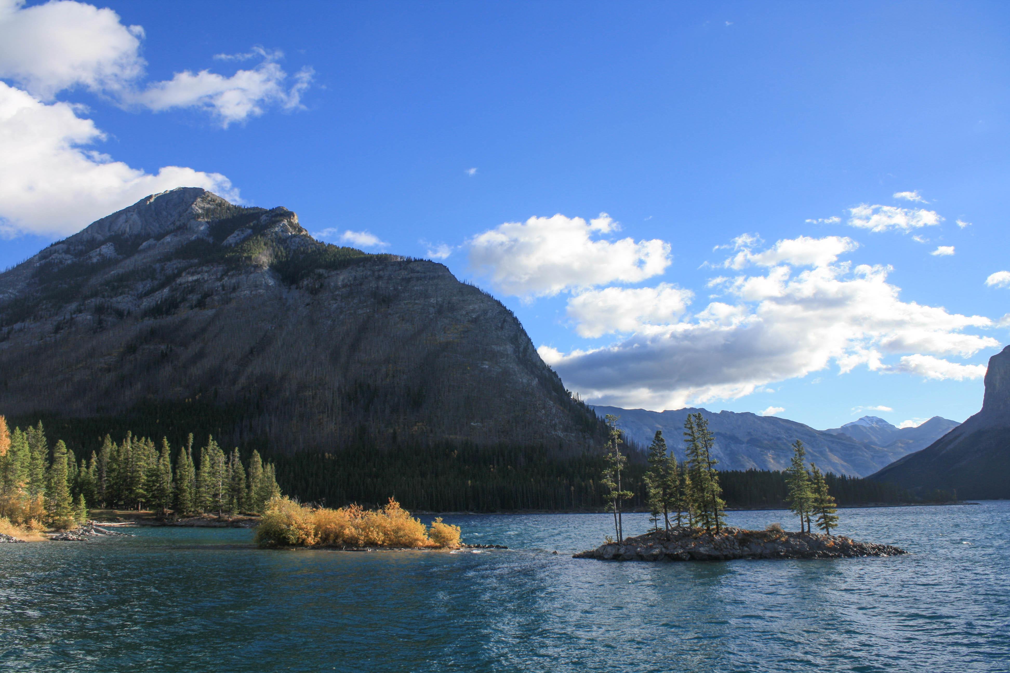 Of course, if you’re not ready to brave the frigid waters to see what lies below, your surface-level appreciation of the lake won’t be any less rewarding. The magnificent mountains all around you will impress you, and you’ll gain a renewed appreciation of color as you take in the contrast of the deep-blue water of the lake; the rich green of the hillside trees hemming in the lake, speckled with the golden autumnal yellows of quaking aspens; the puffy white clouds floating across a cerulean sky; and the occasional flash of red and white of a fluttering Canadian flag.
Moraine Lake
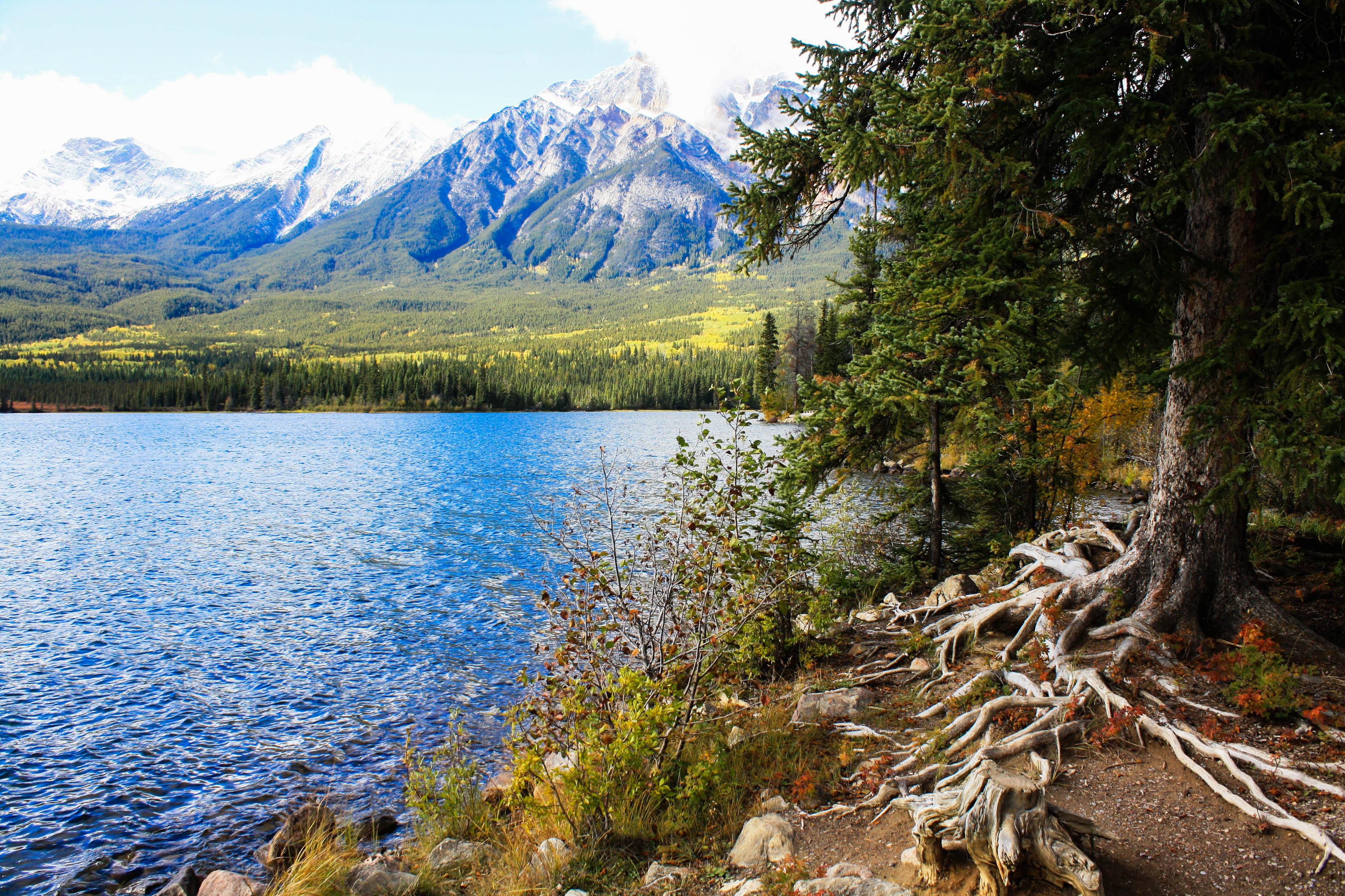
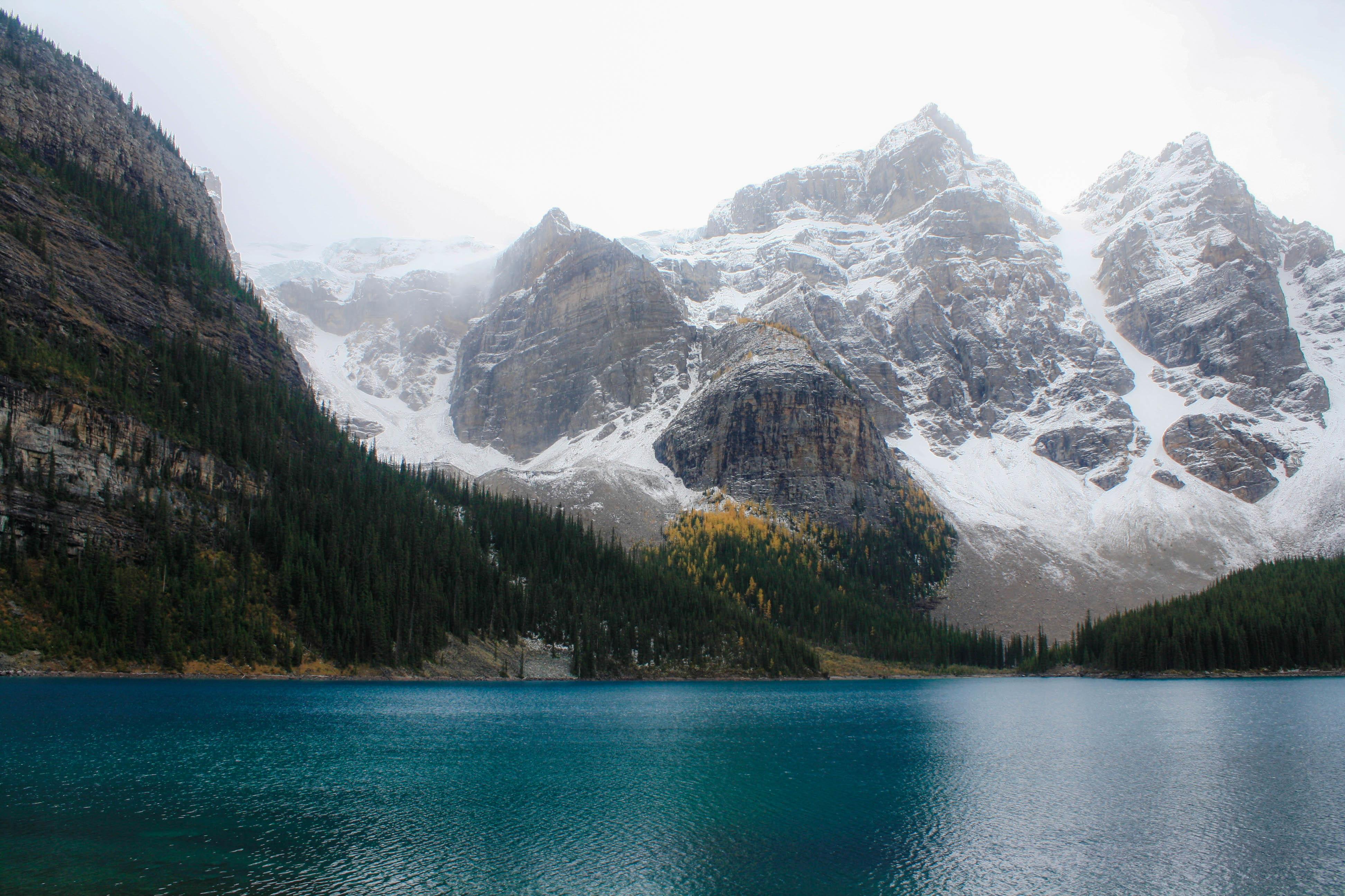 Heading north, I turned onto Highway 93, better known as Icefields Parkway, one of the most beautiful drives in the world. For about 143 miles, I sliced through jaw-dropping scenery of majestic mountains and glaciers, thick forests, and the Bow River flirting with the road in an endless game of tag and retreat. Along the way, an hour diversion from the parkway brought me to the shores of the breathtaking Moraine Lake for a little hiking. Situated in the Valley of the Ten Peaks, a valley crowned by 10 mountains that soar more than 10,000′, the lake itself lies at an elevation of nearly 6,200′ and has a surface area of 120 acres. Refraction of light off the rock flour that glaciers feed into the lake gives rise to its staggering blue-green color. A flat, easy walk along the shore rewarded me with astounding views as I meandered through conifers along the water’s edge and utilized fields of rocks and stones to build my own little cairn—the only thing I left behind at this pristine spot.
Lake Louise
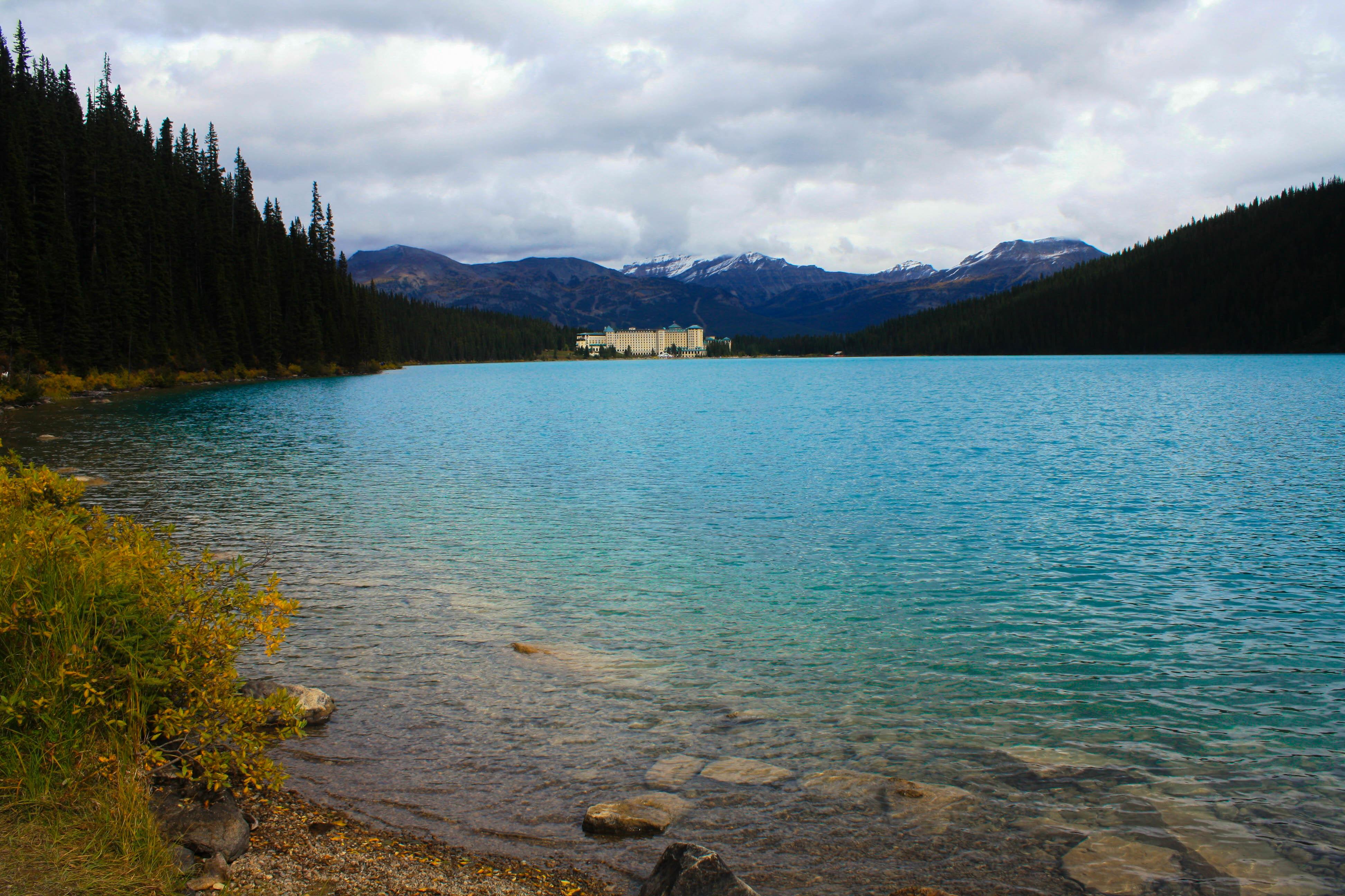 More accessible from Icefields Parkway (and much more popular), Lake Louise is the stuff of legend. Named for Queen Victoria’s fourth daughter, Lake Louise, like Moraine Like, achieves its iconic turquoise color from the refraction of light off the rock flour in the water. From the grounds of the very photogenic Fairmont Chateau Lake Louise, a world-class hotel built by the Canadian Pacific Railway in 1890 and rebuilt after fires and expanded over the decades, most recently in 2004, I stood transfixed by the scene before me: the inconceivably colored water surrounded by snowy mountains with conifers rising up their sides to the clearly defined tree line, a red canoe slowly being paddled across the water by a couple in no rush to get anywhere, and, at the far end, Victoria Glacier, intermittently being illumined by sporadic sunshine. I strolled along the smooth 1.2-mile lakeside trail to the opposite end, where other more challenging trails diverged. I spotted amusing chipmunks scrambling around the rocks as well as lovable birds in tree branches above me and a couple of courageous rock climbers even higher up—two dots of red and yellow fleece against the imposing gray mountain face. From here, the sprawling 552-room Fairmont Chateau Lake Louise looks positively dwarfed by the phenomenal mountains behind it. I was so amazed by everything around me that I didn’t want my time here to end. So, to extend my visit, I returned to the hotel and appreciated the view from a different angle—enjoying a proper afternoon tea with scones and finger sandwiches from a window-side table that framed the view just perfectly.
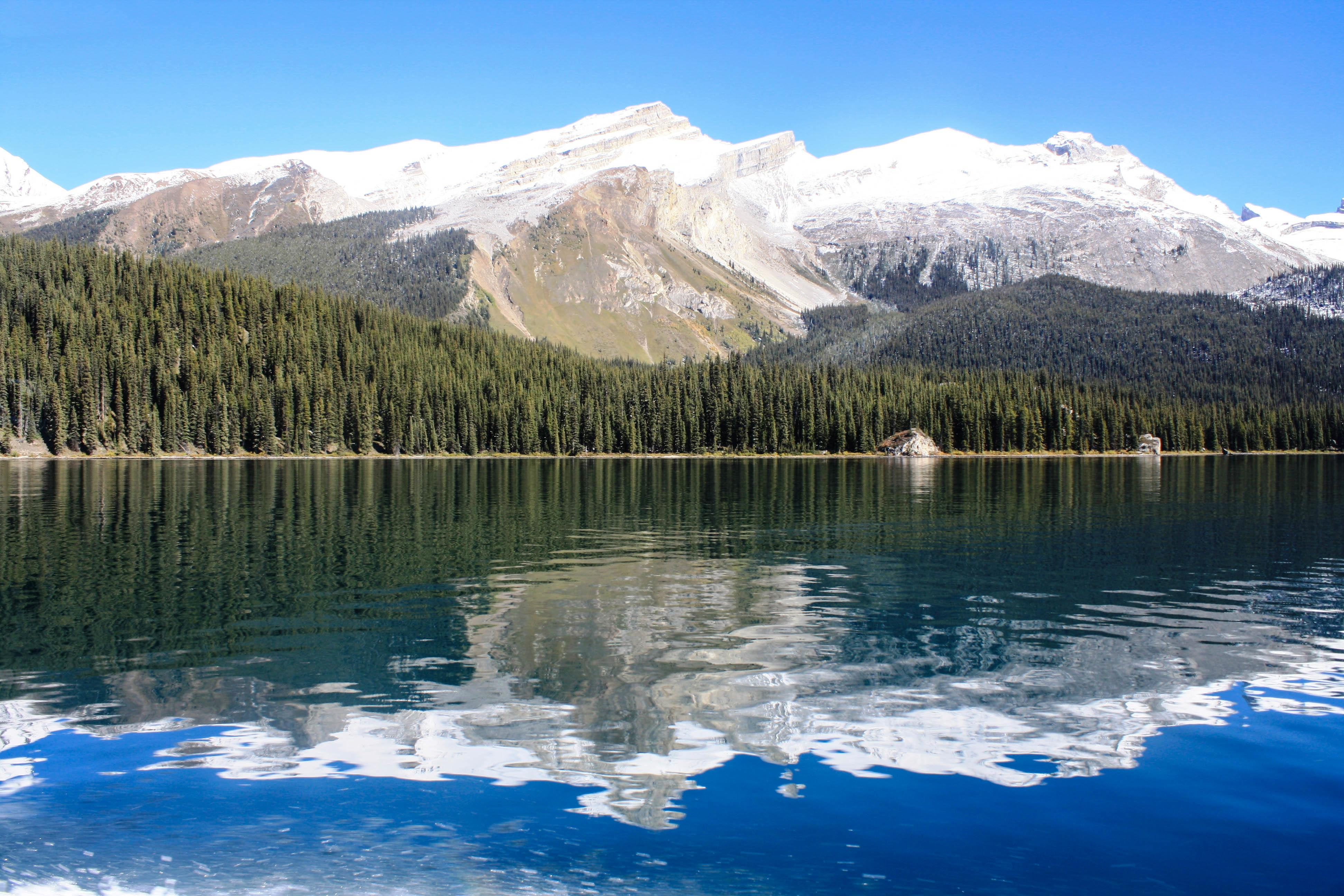
Emerald Lake
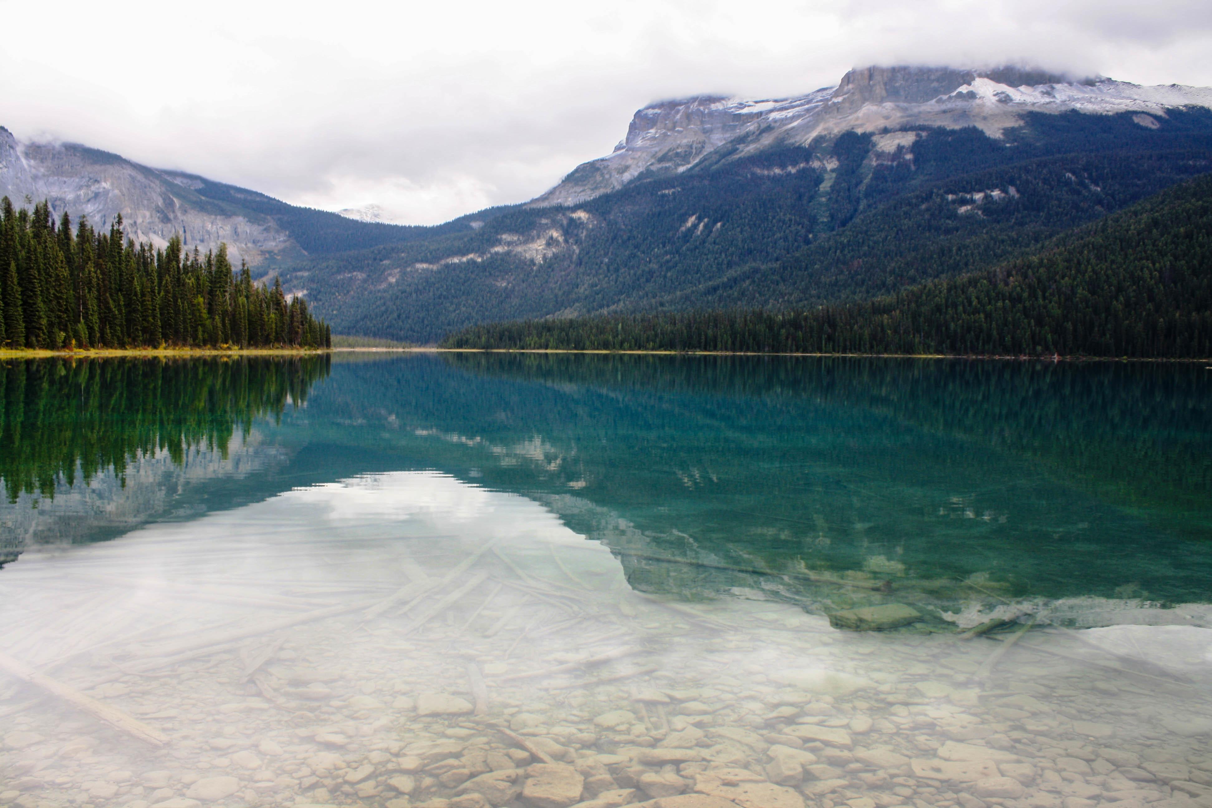 North of the hamlet of Lake Louise, I detoured off Icefields Parkway and onto the Trans-Canada Highway, headed into British Columbia and Yoho National Park in a westerly direction until a secondary road abruptly shifted north toward my destination. Despite the handsome lodge occupying an entire peninsula that juts into tranquil Emerald Lake and welcomes lucky visitors, this idyllic place exudes a silent remoteness that’s hard for a New Yorker to fathom. Western hemlocks, western red cedars, western white pines, and western yews surround the secluded lake, enveloped by the mountains of the President Range, the 8,527′ Mount Burgess, and the 9,114′ Wapta Mountain. In September, before a six-month freeze sets in, the flora’s yellow and red fall colors are flawlessly reflected in the jewel-like lake. I stood on the shore for quite some time, bewitched by the lake’s color that could rival its eponymous gemstone, inhaling the untainted air and the pure scents of nature, and let the silence wash over me—until a tour bus of garrulous Chinese tourists arrived and ruined the mood. It was time to move on.
Peyto Lake
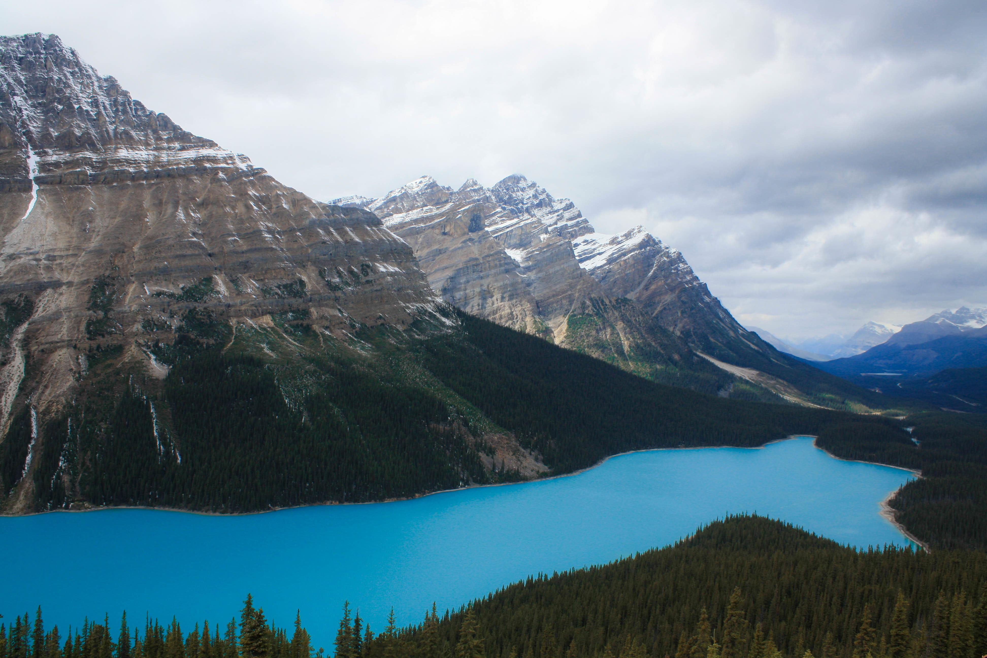 Back in Alberta, I continued north for about a half hour until the turnoff for Peyto Lake. Just a short uphill walk from the parking area, I was treated to one of the most famous views in all of Canada. Named for an early trail guide and local trapper, Peyto Lake is situated in a valley at an elevation of 6,100′, nestled between a trio of mountains that near 10,000′ with thick growths of trees that gradually peter out as they rise up their sides. Viewed from the platform at the end of the trail, the two-square-mile glacier-fed lake below bears an impossibly vibrant turquoise color that looks artificial, unreal, unearthly, enhanced by talented graphic artists and photography manipulators. And it’s unforgettable.
Medicine Lake and Maligne Lake
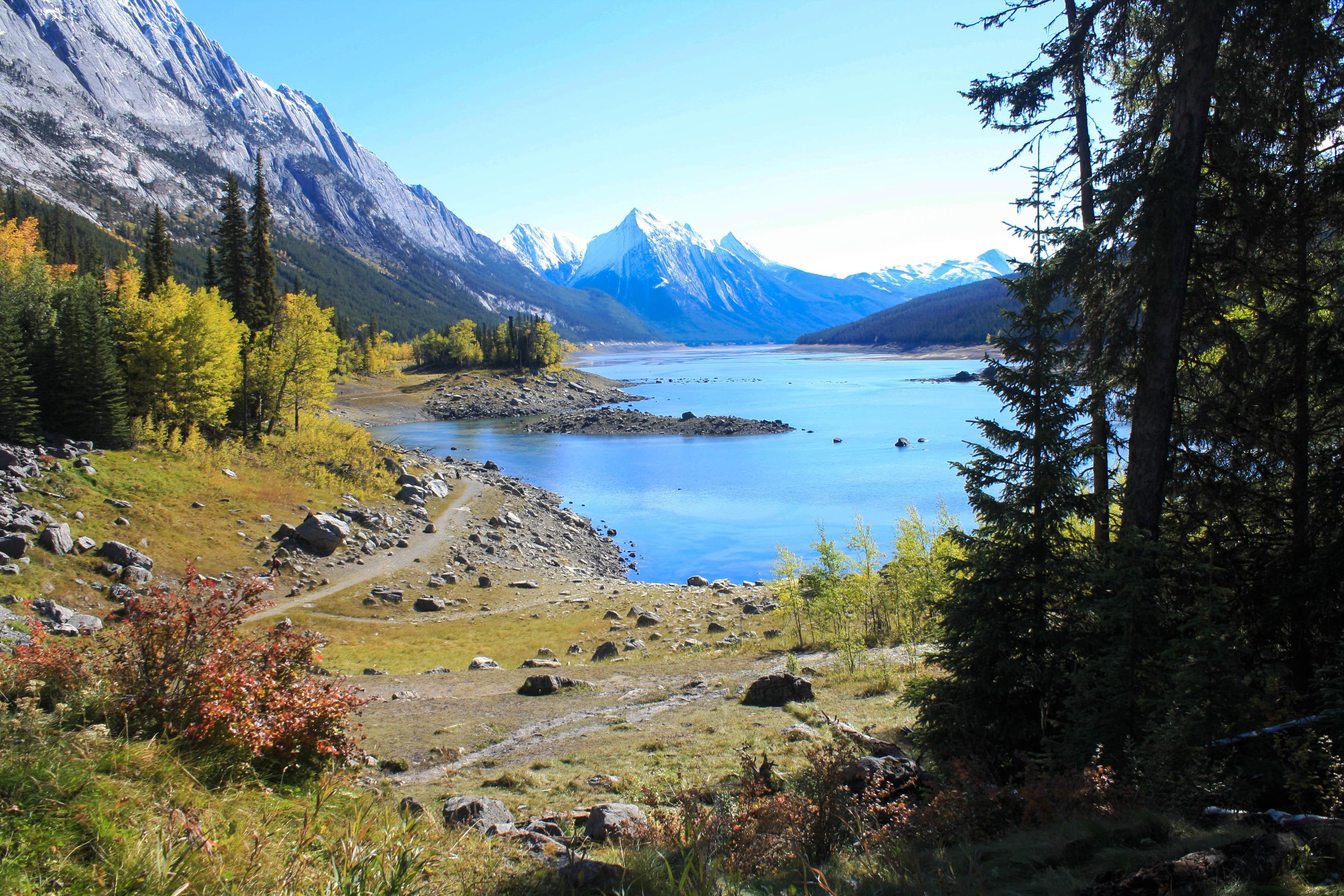 I arrived at Jasper, my final destination during this weeklong jaunt and the perfect base to behold the alluring lakes in Jasper National Park. At the top of my itinerary was the scenic drive on the way to a duo of stupendous lakes, the first of which I happened to have all to myself. The serenely stunning—and rather mysterious—Medicine Lake extends for just over four miles, and its fairly shallow and crystal-clear water makes it easy to see the rocks littering the lakebed. Fortunately, I was here when the lake still had water—but that’s not a sign of catastrophic climate change. Every year, once the melting glacier waters that feed the lake taper off at summer’s end, the lake’s waters start to drain more rapidly than they can be replenished through sinkholes at the bottom into what is often regarded as the world’s largest inaccessible cave system, leaving behind a large mudflat with just an occasional pool of water here or there.
 Farther down the road, I stopped at the largest lake in Jasper National Park—Maligne Lake, at 14 miles long and nearly one mile across. After admiring all these lakes from the shore, it was time to get on one, so I took one of the world’s best boat rides—a 90-minute cruise that sailed me and a handful of others out onto the blue lake. Its name derives from the French word for malignant, or wicked, but that seems more appropriate for the turbulent Maligne River that feeds and drains it rather than the glassine lake itself. On the east side, the jagged sawtooth limestone mountains of the Colin Range contrast with the more subdued forms of the shale and quartz mountains of the Maligne Range on the west side, and sailing between them, with their sharp reflections in the still water, is an indelible experience. So is the scheduled stop on little Spirit Island, an enchanting blip of land with a cluster of trees. One of Canada’s most photographed spots also sports a misnomer. Spirit Island is an island only some of the time: For most of the year, it’s really a peninsula, attached to the lakeshore, but spring rain and snow melts that raise the level of the lake wash over the connection, isolating the unsubmerged part as an island.
Patricia Lake and Pyramid Lake
 Before I began my descent from the Rockies into the flatlands on my way eastward to Edmonton, I had one more stop to make—a pair of neighboring lakes in Jasper National Park. Patricia Lake, named for one of Queen Victoria’s granddaughters, is irresistibly accessible: Just pull over and park, step out of your car, and look at it and its fantastic backdrop of thick green forests and the incredibly photogenic and roughly triangular Pyramid Mountain. Like Lake Minnewanka, Patricia Lake also holds an underwater secret. During World War II, the lake was the site of Project Habbakuk, a plan to use an ice-based composite material to construct an unsinkable aircraft carrier measuring 2,000′ long. A smaller model was constructed during the 1942–43 winter on the frozen lake, and as more components and weight were added, the bottom of the hull was sawn free from the lake ice, leaving the model free to float. After its internal refrigeration was switched off in June, it lasted the entire summer before it melted and sank. Today, the west wall of the structure survives intact at the lake bottom, along with the broken remains of the rest of it at depths of 40′ to 90′. If you can make it that far underwater, you’ll find a plaque commemorating the site.
 Less than two miles down the road, I stopped for a hike around Pyramid Lake, a kidney-shaped body of water with a surface area of half a square mile. Its placid and highly reflective waters provide captivating mirror images of the mountains on the opposite side, including snow-capped Cairngorm, Mt. Kinross, and Pyramid Mountain, all of which exceed 8,500′. Here at this enthralling location, I saved the best for last—little Pyramid Island, accessed via a wooden footbridge over the water. I walked along the short trails through the trees, stopping to make friends with a curious red squirrel, and reached the tip of the island. From here, the views of the lake and the mountains, with the yellow of changing quaking aspens standing out brilliantly against the green fir and spruce trees, the blue sky, and the white cumulus clouds, completely beguiled me. This was nature at its best, impeccable and mesmerizing, and Canada is extraordinarily lucky to have it.

